
A hypothesis which posits a linear sequence of events rarely works in the real world. Nonetheless, we took a crack at just such a simplistic shopping-list sequence:
- Venus had water oceans, an atmospheric pressure of order a bar, and plate tectonics.
- Steadily increasing solar luminosity drove a runaway moist greenhouse.
- Rapid erosion occurred as the oceans were being lost.
- Erosion ceased and plate tectonics shifted to stagnant lid volcanism.
It’s straightforward to irresponsibly tweak a model that draws on those four events to turn the Earth’s topographical power spectrum into one that channels modern-day Venus. Rapid erosion pretty much flattens the planet out entirely in the absence of tectonic uplift. Then static-lid emplacement of igneous provinces at a pace of order a cubic kilometer per year builds the spectrum back up to what we see today. And a cherry on top: assume that the lava production rate for Venus is the same as for Earth. This means that Venus was habitable up to about 500 Myr ago, that is, up to around around the same time as the Cambrian Explosion. Intoxicating stuff.
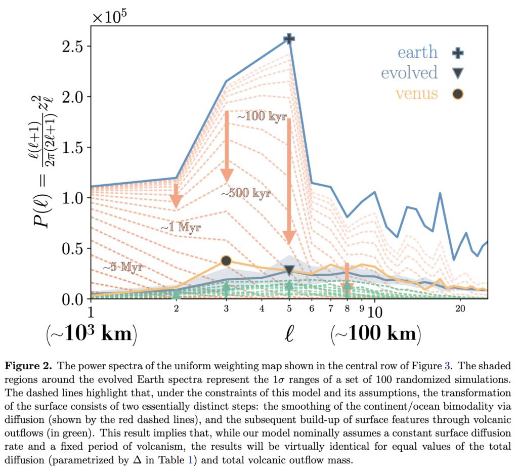
Understandably, this modeling approach got a lot of static from the referee. There are potential problems with all of points one through four above, and more generally, we attacked the problem from the standpoint of shocking naivete. It’s a shoot first, ask questions later mentality applied to the scientific enterprise. Submit first, read the literature later.
I do think there’s something to be said for the quick-draw approach, though. Mötley Crüe recorded Too Fast For Love in a couple of days on a budget where packs of Marlboros were material. Then, less than a decade on, it took them something like year to finish Dr. Feelgood at enormous expense. The point is, there’s a risk of getting bogged down if one strives for dissertation defense level completism.
Also, did I mention that I’m a fan of the GPT architecture?

At any rate, on point three of our four-point plan, we got the following criticism from the referee: The authors seem unaware that erosion of broad continents is slow. We still have 55 million year old Laramide topography in Colorado. See old paper by Clem Chase.
I was indeed unaware of that. The sediment load of the Mississippi River is 500 million metric tons per year. That corresponds to a removal of 0.25 cubic kilometers of rock per year. The Mississippi’s watershed is 3.2 million square kilometers (and includes Colorado). In the absence of uplift, North America’s topography is sanding down at a rate of a kilometer (3280 feet) per 12.8 million years. That makes the presence of the Flatirons outside of Boulder indeed something of a puzzle…
According to the Wikipedia, “Whataboutism or whataboutery (as in “what about…?”) is a pejorative for the strategy of responding to an accusation with a counter-accusation instead of a defense against the original accusation.”
So what about that strange geological feature on the border of Champaign and Douglas counties in East-Central Illinois?
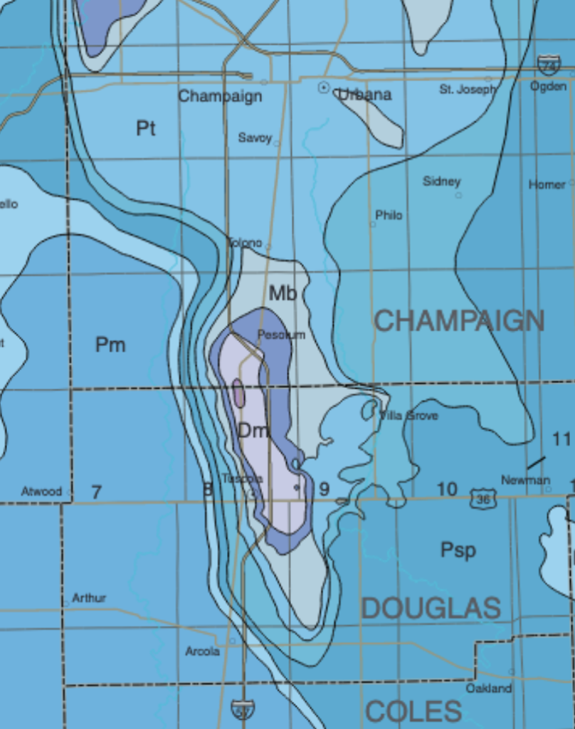
The tiny cornfield-sized purple ellipse in the center of the bedrock map corresponds to the Silurian Moccasin Springs formation which consists of 420-million year old reefs. Moving out from the bulls-eye core, are bedrock rims of middle Devonian rocks, the New Albany Shale, the Borden Siltstone, the Tradewater Formation, the Carbondale Formation, the Shelburn Patoka Formation, the Bond Formation, and finally several miles to the east, the 296-million year old rocks of the Mattoon Formation. At some point in the past 296 million years, something pushed the Silurian rocks upward by roughly 2000 feet. From a bedrock perspective, the severity of the uplift is similar to what one finds on Baseline Road in Boulder Colorado, which provides a good view of that Laramide topography mentioned by our referee:
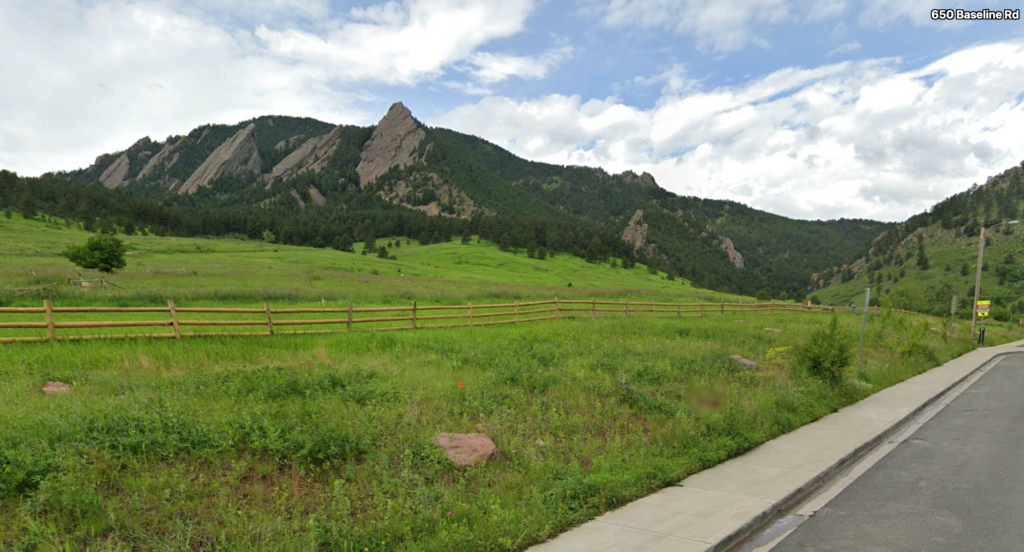
The sandstone rocks of the Fountain Formation that make up the Flatirons are, coincidentally, also 296 million years old. They were deposited in alluvial fans at the same time as shallow water sediments were piling up to create the Mattoon formation.
Dropping into Champaign County Road 100 North, at the point where the age gradient of the bedrock reaches its maximum, reveals an absolutely flat landscape. Zero hint of the weird stratigraphy that lurks just beneath the 12,000-year-old veneer of Wisconsin glacial till.
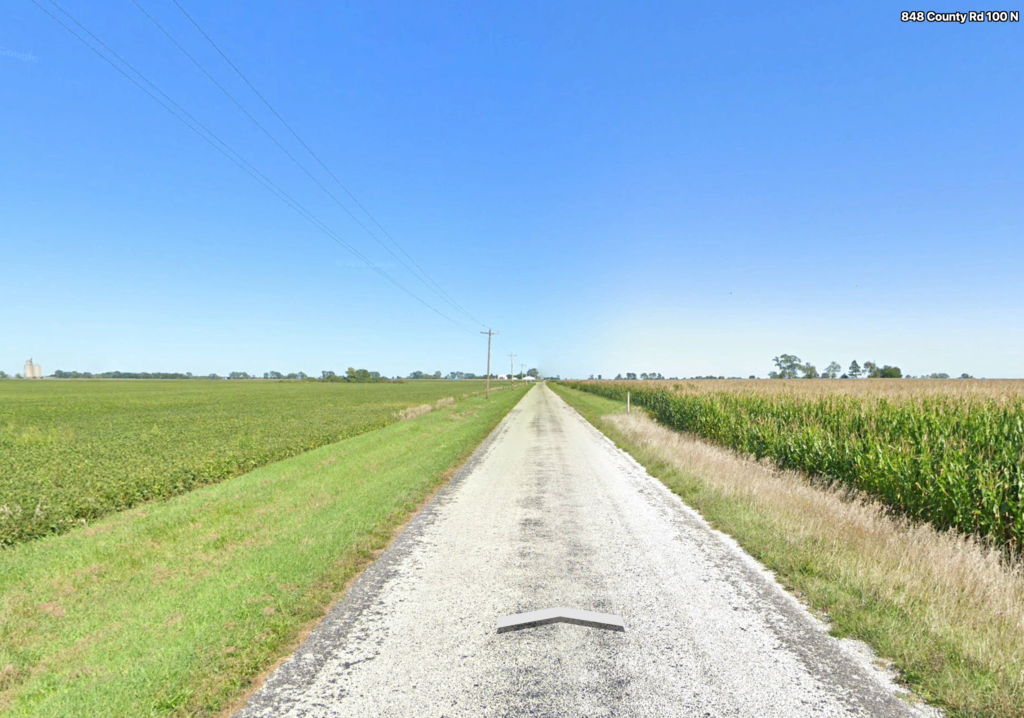
So what’s going on? Why does Boulder CO sport rugged peaks whereas Champaign IL is completely flat? Is the Fountain Formation more resistant to weathering? Is the older tectonic age of the “Champaign Uplift” responsible for its complete surface obliteration? Or something else?
Granted, I don’t yet know enough about geology to be certain, but as far as I can tell, there’s no literature out there that specifically investigates the Champaign Uplift. I’m going to turn on comments for this post in the hope that someone might know something. Clearly, the uplift, or more properly, the anticline, is associated with the La Salle Anticlinorum, and is a small localized region where the local folding was very pronounced. Could it be of similar province to the mysterious Hicks Dome further south in Illinois?
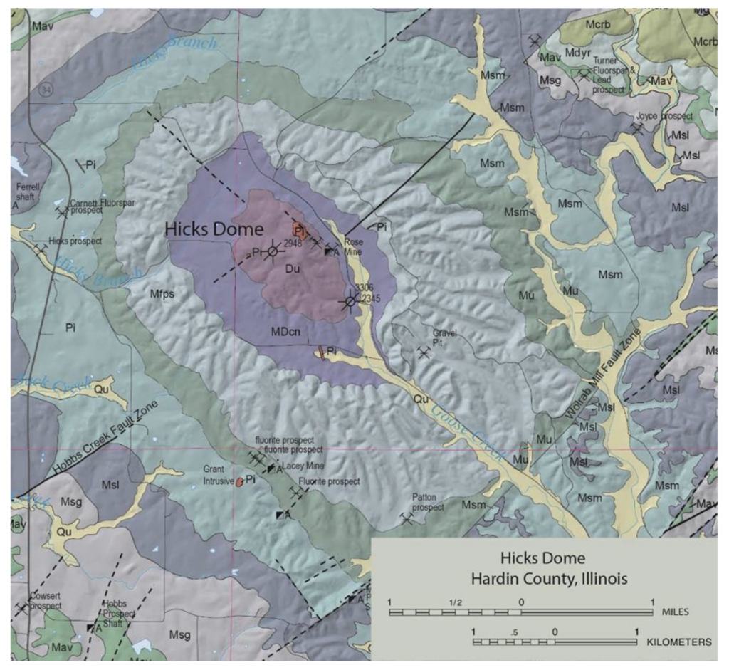
A description of Hicks Dome reads very much like a description of the Champaign Uplift:
“The dome is about 10 miles in diameter, and rocks at its apex are uplifted 4,000 feet. Middle Devonian rocks at the center are surrounded concentrically by younger rocks out to Pennsylvanian on the rim.”
At Hicks Dome, the source of the uplift was an igneous intrusion that pushed its way up 260 million years ago:
“In 1952, St. Joseph Lead Company drilled a well on the apex of Hicks Dome in Hardin County, Illinois, primarily to explore for oil or gas, and with the objective of testing the St. Peter sand horizon, which had not been reached in a previous well on the flank of the dome. A normal sequence of formations was encountered down to 1,600 feet, but at about that depth the drill entered a confused brecciated zone, which persisted to the bottom of the hole at 2,944 feet. This is interpreted as one of the explosion type breccias, or diatremes, common in this Illinois-Kentucky area, as well as in nearby Missouri. A correlation of formations between this and the earlier Fricker well is presented. It is suggested that Hicks Dome is an incipient or uncompleted cryptovolcanic structure.”
The situation is illustrated nicely by the stratigraphic column:

To test this hypothesis we’d need to similarly drill into the Champaign Uplift. Clearly, some drilling already must have been done. Otherwise, there would seemingly be little reason to suspect that the Champaign Uplift is present beneath the till. Moreover, there would presumably need to be a fairly large number of wells in order to resolve the feature to the extent that it’s shown on the bedrock map. (Ed. — Perhaps seismic data can reveal such detail in the absence of drilling. You should really look into that.)
Anticlines are good at trapping oil. If one of the upper layers of the stratigraphic column is impermeable, then oil and gas will tend to migrate along the uplift gradient. A little bit of googling strikes an informational gusher in the form of the Illinois Oil and Gas Resources mapping application.
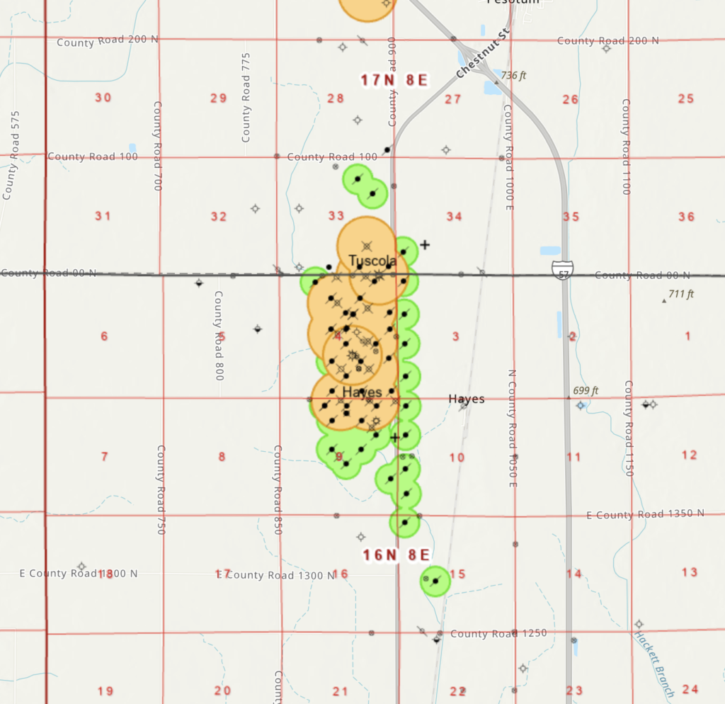
Look at that! The Champaign Uplift is shot through with oil wells. Each well location is clickable, and brings up a record at the Illinois Geological Survey. Clicking on a site close to County Road 100 yields:
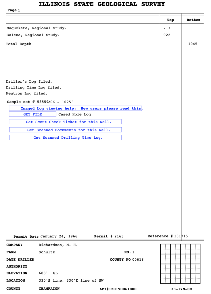
Further clicking reveals the scanned well logs:
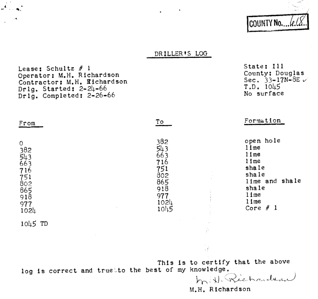
The wells were all drilled in the mid 1960s and they all go down about 1000 feet, at which point they tended to strike oil, typically generating about 50 barrels per day per well. There are about 50 such wells tapping the uplift, and assuming that they produced for a year, they generated about a million barrels of oil. USD 80M at current prices. Sweet.
Having hit the pay zone, however, it appears that there was no interest in drilling further. Had they gone down another few thousand feet might they have found an intrusion, an incipient Devil’s Tower? The flat landscape stretching away to the horizon gives no hint.
