Image Source.
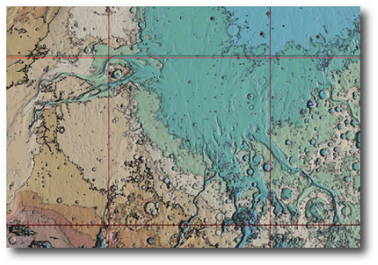
I now have a topographic Mars globe on my desk, and I’ve been staring at it. It’s common knowledge that the northern Martian hemisphere is low-lying and nearly uncratered, but this was never hammered home to me until I spent time staring at an actual globe, tracing the shorelines of the vanished ocean.

Image Source.

Greg,
It interesting that you bring this up. For, just today data from the MARSIS radar on the mars express probe was released showing numerous buried craters, implying that the ocean bed was as old as the rest of the planet. A tremendous amount of dust and rock must have been moved to create the smooth surface we see.
Hi Theo,
Thanks for the comment. It inspired me to read up on the MARSIS instruments and the new results. It’s amazing to me that a satellite-borne radar can image structures that are literally kilometers below the surface.
I didn’t find any data released today (Dec. 27th) but there is an interesting Nature article by Watters et al. from Dec. 14th link here (paid US $199 subscription unfortunately required, despite the fact that the European taxpayers funded the mission).
The above image is a screenshot from the Nature article. The white polygons show the areas in the northern lowlands that were imaged by the ground-penetrating radar. The black circles are the newly inferred craters. My understanding from the article is that the numerous white circles are inferred craters based on the previously known topographical data.
If the ocean bed is as old as the rest of the planet, then I guess that’s strong evidence against the northern lowlands being the product of early plate tectonic cycles.
I bet we’ll eventually end up finding out that the Venusian ocean lasted quite a bit longer than the Martian one.
Greg